
Where Palm Coast Sits, and How Big It Is
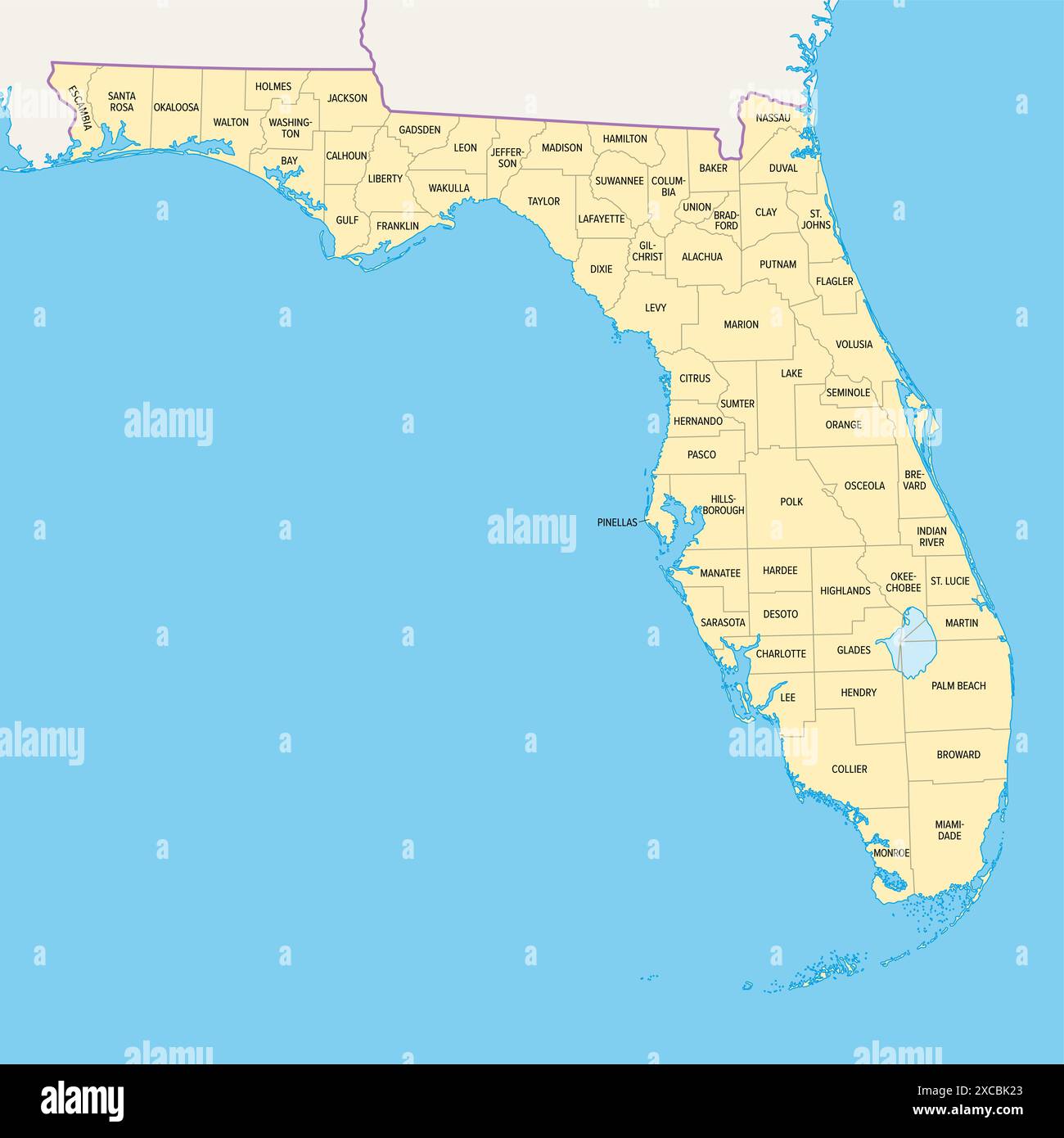
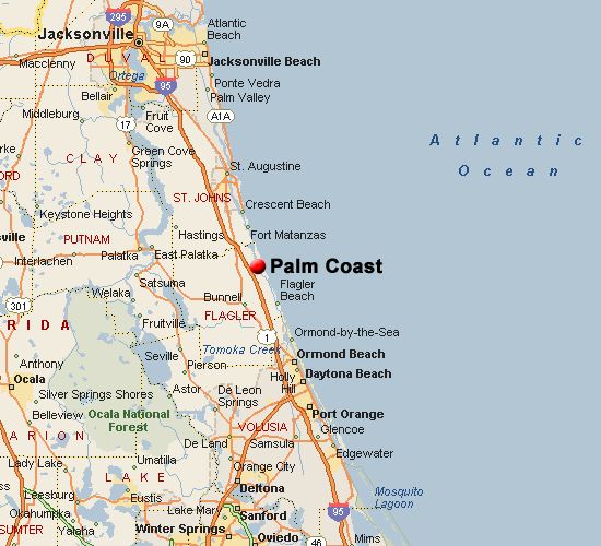
Palm Coast sits in Flagler County on Florida’s northeast coast. Census Reporter’s American Community Survey profile puts its land area at roughly 96.3 square miles, with a population density around 1,108 people per square mile, well below the density of South Florida’s built-up cities. The city is split by Interstate 95, with crossings at three interchanges, and is bordered on its eastern edge by the Intracoastal Waterway.
Palm Coast runs on Eastern time, not Atlantic time, correcting a labeling error that appears on at least one popular city-data listing site. According to neighborhood-guide pages published by the Welch Team real estate brokerage, the drive to St. Augustine runs about 25 miles and to Daytona Beach about 30 miles, with Jacksonville and Orlando both within a roughly 60-to-90-mile range for commuters.
Two Founding Dates, Both True
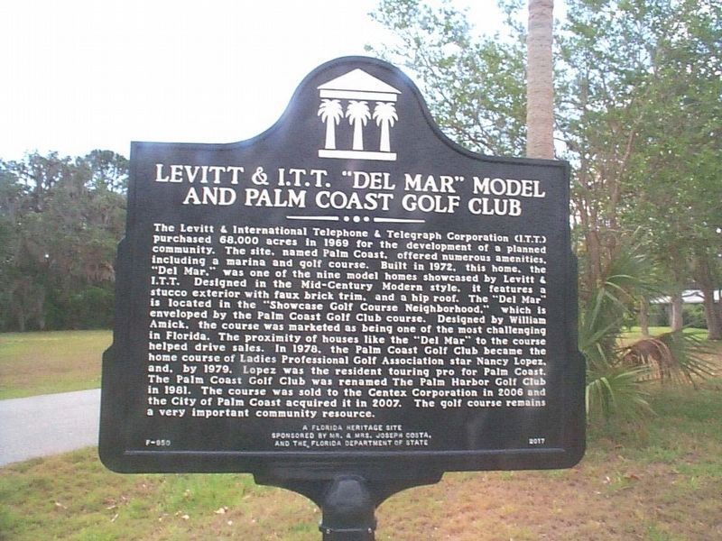
Palm Coast has two dates attached to its origin, and both are correct for what they describe. In June 1969, the ITT Corporation, fresh off acquiring the Levitt and Sons homebuilding firm, announced plans for a 20,000-acre planned community on what had been rural, largely undeveloped Flagler County land, according to a detailed local history published by AskFlagler. Development, sales, and the “pioneer” homesteaders who moved in through the 1970s and 1980s all predate any city government: for nearly three decades, ITT itself ran roads, water, and sewer service through a private-public arrangement.
Incorporation, by contrast, came on December 31, 1999, following a referendum held September 21, 1999, one week later than planned because Hurricane Floyd forced a postponement, per the City of Palm Coast’s own official history page. Voters approved incorporation 65.6% to 34.4%. That is the date the city of Palm Coast, as a government, began operating.
Dr. J. Norman Young, the Levitt project manager who helped plan and name the development, predicted in 1969 that Palm Coast would eventually house 750,000 residents, a number that looked absurd next to Flagler County’s roughly 4,500 residents at the time. More than fifty years later the city has passed 100,000, a fraction of that original marketing forecast.
Why do some sources treat 1969 and others 1999 as Palm Coast’s founding year? The confusion usually comes from real-estate and tourism material that markets “established since 1969” without distinguishing land development from city government. 1969 is when ITT began building; December 31, 1999 is when Palm Coast incorporated as a self-governing city.
Population, Reconciled
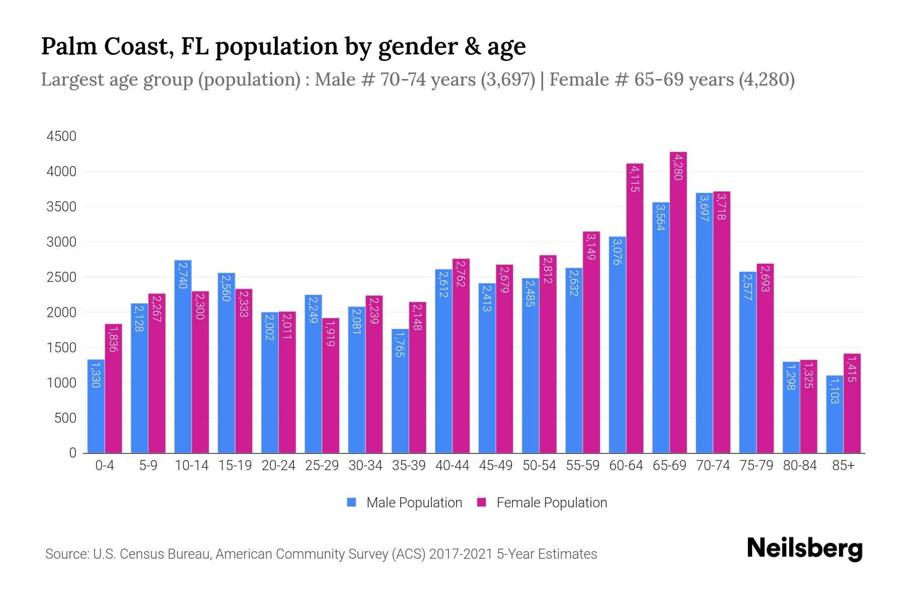
Every population figure attached to Palm Coast needs a date next to it, because the growth rate has been unusually fast and sustained. The 2000 census counted 32,832 residents. The 2010 census counted 75,180. The 2020 census counted 89,258. A 2022 Census Bureau estimate reported by FlaglerLive put the population at 98,411, a 10.3% jump in two years that made Palm Coast the fifth-fastest-growing city in Florida over that span. The most recent American Community Survey one-year estimate, for 2024, puts the population at 106,726.
The Daytona Beach News-Journal reported in May 2023, based on University of Florida estimates, that Palm Coast had already overtaken Deltona as the largest city in the Deltona-Daytona Beach-Ormond Beach metro area, and had become the largest city across Flagler, Volusia, St. Johns, and Putnam counties combined. Deltona’s own growth over the same stretch was comparatively modest, up about 2% versus Palm Coast’s double-digit gain.
| Year | Population | Source | Note |
|---|---|---|---|
| 2000 | 32,832 | U.S. Census (decennial) | Baseline |
| 2010 | 75,180 | U.S. Census (decennial) | +129% over 2000 |
| 2020 | 89,258 | U.S. Census (decennial) | +19% over 2010 |
| 2022 | 98,411 | Census Bureau estimate, via FlaglerLive | 5th-fastest-growing city in Florida, 2020 to 2022 |
| 2024 | 106,726 | Census Bureau ACS 1-year estimate, via Census Reporter | Latest published figure at time of writing |
Three straight census counts and two subsequent estimates all point the same direction: a city that more than tripled between 2000 and 2024 without a single documented year of decline in that stretch.
How large is Palm Coast compared to nearby cities now? By 2023, it had passed Deltona to become the largest city in its four-county metro area, and it ranks among the 30 largest cities in Florida by the most recent Census Bureau estimates.
Wildfire Risk: The Historical Record Behind the Score
Relocation-scoring sites that flag Palm Coast’s wildfire risk as high rarely explain why. The reason traces to two specific, dated events in the city’s own subdivisions.
In May 1985, fires that became known locally as the “Black Friday” fires burned through Palm Coast neighborhoods over a single weekend. According to the City of Palm Coast’s own retrospective account, 131 homes were destroyed outright and roughly 200 more were damaged; about 10,000 of the county’s roughly 17,000 residents at the time were directly affected. City landscape architect Bill Butler watched his own house on Westford Lane burn that day and later rebuilt on the same lot, where he still lives.
Thirteen years later, in July 1998, fires struck the same general area again, this time large enough that Governor Lawton Chiles ordered the entire county, roughly 45,000 residents, evacuated, according to a Palm Coast Observer retrospective: the only time in Florida’s history a wildfire evacuation order has covered an entire county. Fire crews arrived from dozens of states. City officials have since said the response gap exposed by that event was a direct factor in the push to incorporate Palm Coast as a city later that same year.
The risk hasn’t gone dormant: in April 2025, a 250-acre brushfire in Flagler County was contained after prompting county burn bans, according to Spectrum News, a reminder that dry-season fire weather remains a recurring condition here.
| Hazard | Historical record | Practical note |
|---|---|---|
| Wildfire | 1985: 131 homes destroyed. 1998: entire county (~45,000 people) evacuated. | Highest risk during dry-season drought conditions, typically spring |
| Direct hurricane hit | Last confirmed direct hit: Hurricane Charley, 2004 | Rare compared to regional-impact storms |
| Regional hurricane/tropical storm impact | Matthew (2016), Irma (2017), Ian and Nicole (2022) | Power outages and coastal erosion, without a direct eye passage |
| Inland flooding | Tropical Storm Fay, 2008, caused severe flooding along the canal system with no coastal surge | Affects inland canal neighborhoods differently than the barrier island |
Has Palm Coast had a serious wildfire since the 1990s? Nothing on the scale of 1985 or 1998, but smaller brush fires, including a 250-acre fire contained in April 2025, still occur during dry stretches and prompt periodic burn bans.
Hurricane Exposure: Direct Hit vs. Regional Impact
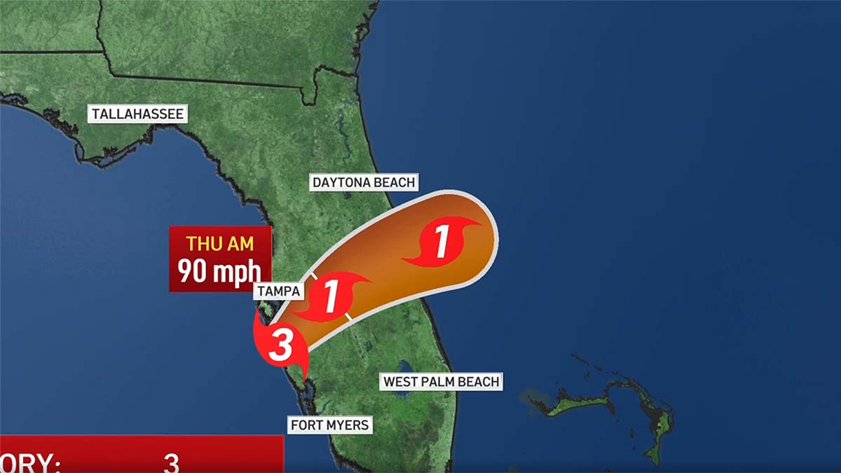
Palm Coast’s hurricane history splits cleanly into two categories, and conflating them is a common mistake in how the risk gets described. The area last took a direct hit, meaning a storm’s eye passed over it, in 2004, when Hurricane Charley crossed the region. Since then, Hurricane Matthew (2016), Hurricane Irma (2017), and Hurricane Ian followed six weeks later by Hurricane Nicole (both 2022) all caused serious regional damage, mainly power outages and beach and dune erosion, without a direct landfall on Flagler County itself, based on reporting by FlaglerLive. Tropical Storm Fay, in 2008, caused severe inland flooding along Palm Coast’s canal system with no coastal surge involved at all, a reminder that the flat, canal-laced inland part of the city faces different exposure than the barrier island to its east.
Flagler County’s own emergency management director has pushed back publicly against a local myth: that the area is effectively immune to hurricanes because it hasn’t taken a direct hit since 2004. Hurricane Ian alone caused an estimated $23.7 million in private property damage countywide, according to FlaglerLive’s damage reporting, despite staying offshore the entire time it affected Flagler.
How often does a hurricane make direct landfall on Palm Coast? Rarely: the last confirmed direct hit was Hurricane Charley in 2004. Regional damage from storms passing offshore, as with Matthew, Irma, Ian, and Nicole, has been far more frequent than direct landfalls.
Crime and Safety: What the Numbers Cover, and What They Don’t
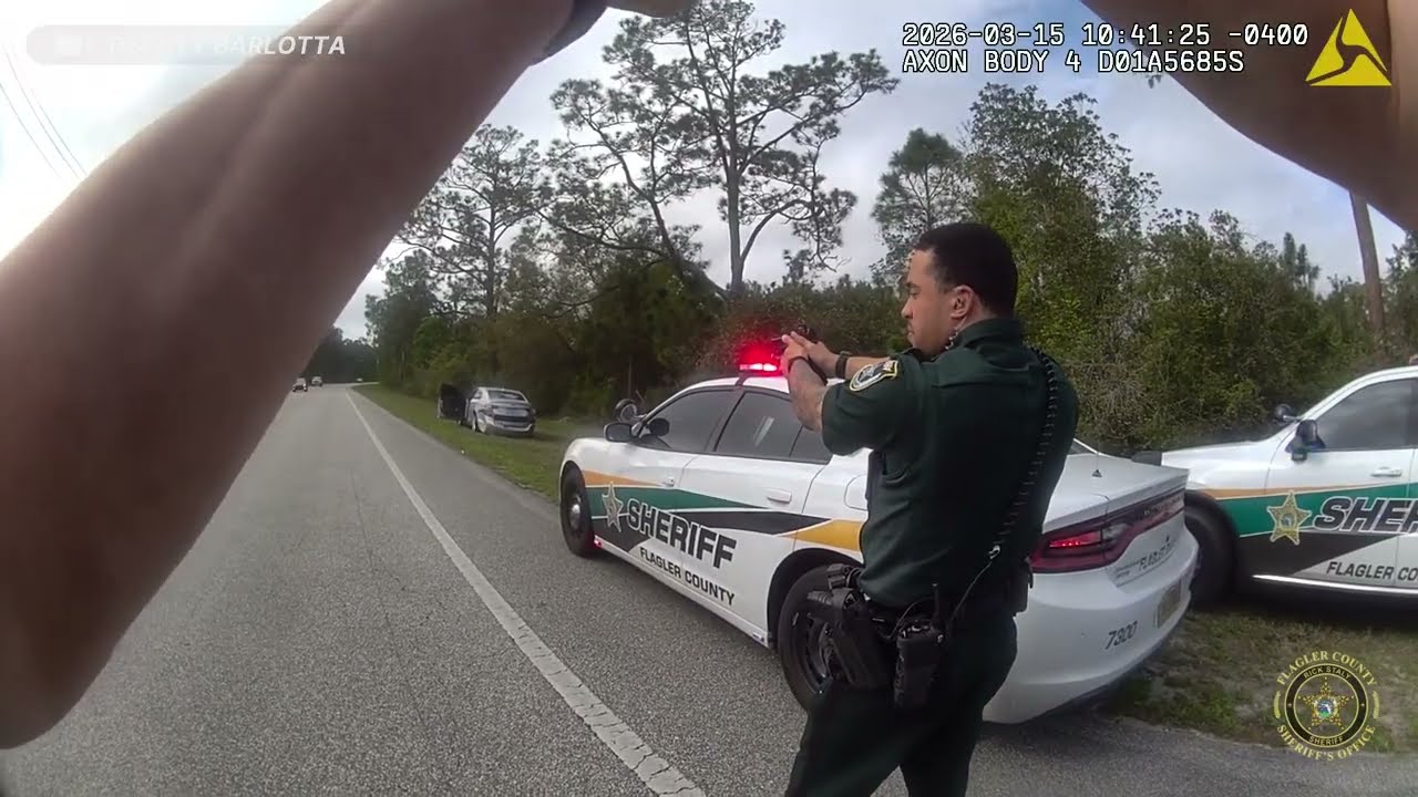
Palm Coast has no police department of its own. Law enforcement is contracted to the Flagler County Sheriff’s Office, which means every crime figure reported publicly is countywide, covering Palm Coast alongside Bunnell, Flagler Beach, and the unincorporated county, rather than broken out by city. A source claiming a Palm Coast-only crime count without saying where the number came from is likely substituting a neighboring jurisdiction’s data or applying a statistical model rather than reporting an official count.
Within that countywide frame, the trend has been consistently downward even as population has grown. The Sheriff’s Office reported crime down 50% since 2017 in its 2023 annual report, and reported in early 2026 that overall crime fell 32% from 2024 to 2025, with crimes against persons dropping from 1,121 reported offenses in 2024 to 817 in 2025, a 27% decline, according to Observer Local News, despite the county adding roughly 4,000 residents over that same year.
A separate, city-specific estimate comes from NeighborhoodScout, which models an overall crime rate of about 7 incidents per 1,000 residents for Palm Coast specifically, based on FBI data for the 2024 calendar year. That figure uses a different methodology, a nationwide statistical model built on FBI-reported crimes, than the Sheriff’s Office’s direct incident counts, so the two shouldn’t be read as confirming each other; they’re two different lenses on the same underlying trend.
| Year | Metric | Figure | Source |
|---|---|---|---|
| 2017 baseline | Overall crime, indexed | Reference point for “down 50% since 2017” claim | FCSO 2023 annual report |
| 2023 | Total reported crimes, countywide | 919 | FCSO, via Observer Local News |
| 2024 | Crimes against persons, countywide | 1,121 | FCSO press release |
| 2025 | Crimes against persons, countywide | 817 (down 27%) | FCSO press release, Feb. 2026 |
Is Palm Coast’s crime rate reported separately from the rest of Flagler County? No. Palm Coast is policed by the Flagler County Sheriff’s Office, so official crime statistics are countywide; only third-party statistical models, like NeighborhoodScout’s FBI-based estimate, attempt a city-only figure.
Neighborhoods, and How They Actually Differ
Palm Coast’s residential areas are organized into “sections,” a system left over from the original ITT and Levitt development, where every street in a given neighborhood starts with the same letter. The letter names are functional, not marketed; most residents use the neighborhood names instead.
- Palm Harbor (C and F sections): the first neighborhood built, bordered by saltwater canals with direct Intracoastal access, home to the European Village shopping and dining complex and the Palm Harbor Golf Club.
- Indian Trails (B section): centrally located along Palm Coast Parkway, close to I-95, built around the Flagler County Public Library and several of the city’s highest-rated elementary and middle schools.
- Cypress Knoll (E section): the smallest non-gated section, known for golf-course-adjacent, well-established single-family homes.
- Seminole Woods (S and U sections): the section closest to Flagler Beach, about 4 miles from its entrance, with more undeveloped land and vacant home sites than the older, denser sections.
- Lehigh Woods (R section): bordered by U.S. 1, White View Parkway, and Belle Terre Parkway, noted for a wider mix of architectural styles than the more uniform original ITT-built sections.
- Matanzas Woods (L section): the northernmost section and closest to St. Augustine, built around a golf course that has changed ownership more than once.
Which Palm Coast neighborhood is closest to the beach? None of the alphabet sections sit directly on the beach; the closest oceanfront living is in the Hammock, an unincorporated community east of the Intracoastal Waterway, reached via the privately operated Hammock Dunes Bridge.
Cost of Living and Housing
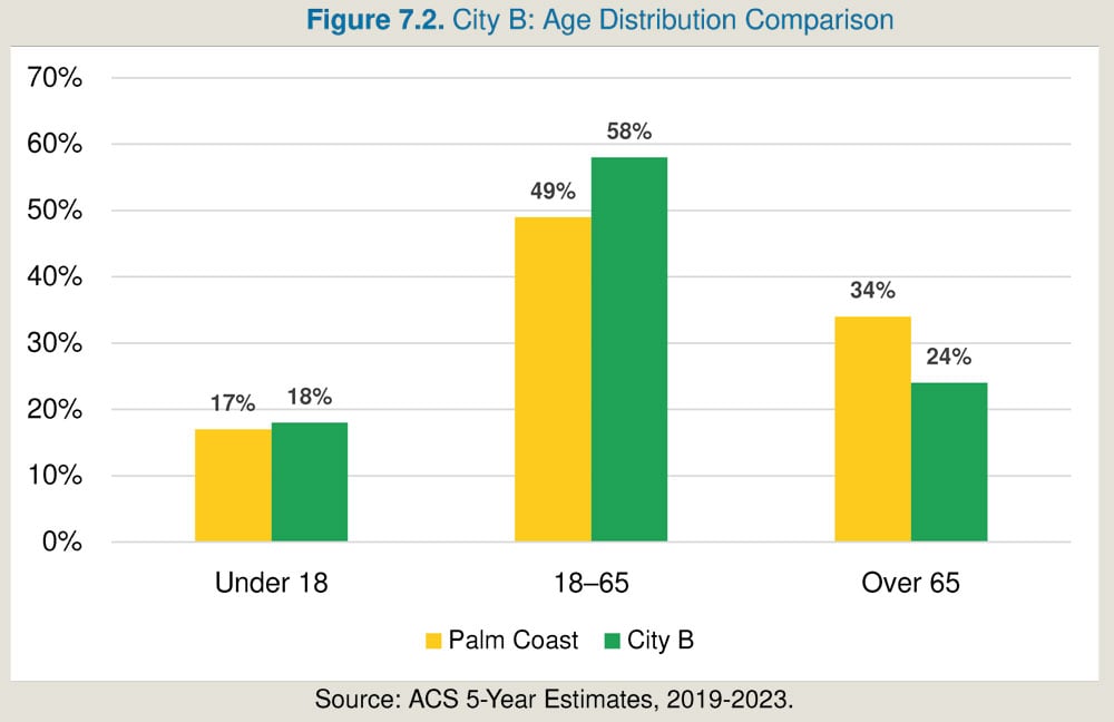
Palm Coast’s cost of living runs below both the state and national averages on the measures available. The city’s cost-of-living index stood at 92.7 in December 2024, against a U.S. average of 100, according to city-data.com’s compilation of American Community Survey figures. Median household income was $82,083 in the most recent Census Reporter ACS profile, about 10% higher than the surrounding metro area’s $73,701, while per capita income at $43,699 sits close to both the Florida and metro averages.
Housing costs have risen sharply from a low base: median home value was $379,800 in 2024, up from $110,500 in 2000, and median gross rent was $1,831 a month.
| Metric | Palm Coast | Comparison |
|---|---|---|
| Median household income | $82,083 | Metro area: $73,701 |
| Per capita income | $43,699 | Florida: approximately $43,582 |
| Median home value | $379,800 | Florida: approximately $396,900 |
| Cost-of-living index | 92.7 | U.S. average: 100 |
| Median gross rent | $1,831/month | Not separately broken out for direct comparison in the sources available |
Climate
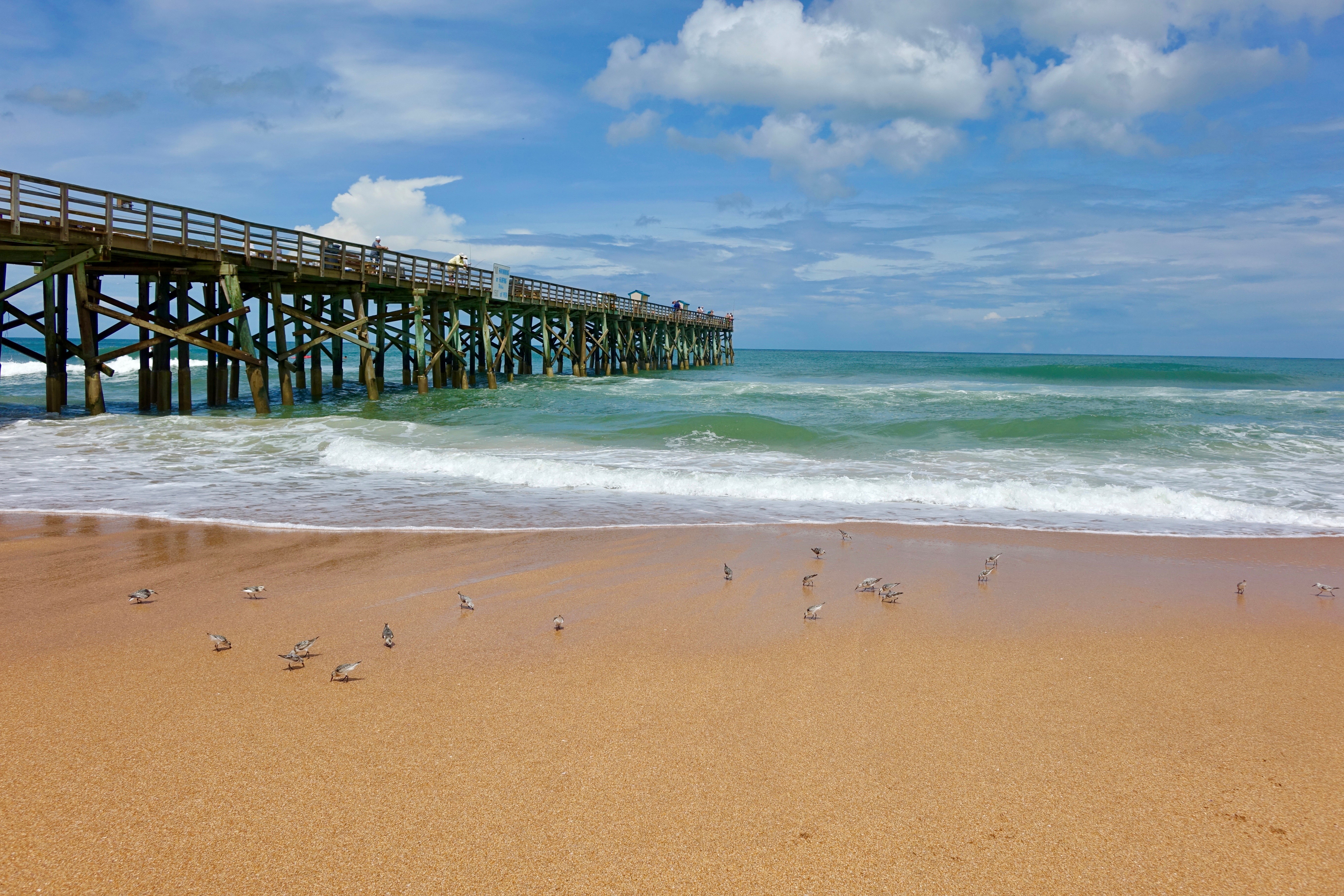
Palm Coast has a humid subtropical climate typical of northeast Florida: hot, humid summers, mild winters, and a hurricane season that runs June through November. No authoritative, city-specific climate dataset with sourced average temperatures or rainfall totals could be located for this page, so specific numbers are left out here rather than approximated from a nearby weather station and presented as local fact.
Comments