
Is Bay Parkway a street or a subway station?
Both, and that overlap is exactly why the name causes confusion: someone told to “meet at Bay Parkway” could mean a mile-long stretch of road, or one of three train stops that don’t connect to each other and aren’t within walking distance of one another.
The three Bay Parkway subway stations
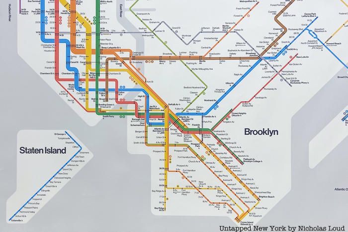
Comparing all three stops in one table is the single most useful thing on this page: no other source lists their opening dates and accessibility status side by side.
| Station / line | Cross street | Neighborhood | Opened | ADA accessible |
|---|---|---|---|---|
| N/W (Sea Beach Line) | Bay Parkway & West 7th St | Bensonhurst | June 22, 1915 | No elevator |
| D (West End Line) | Bay Parkway & 86th St | Bensonhurst | July 29, 1916 | Yes (elevator at NW corner of 86th St and Bay Pkwy) |
| F (Culver Line) | Bay Parkway & McDonald Ave | Mapleton / Midwood border | March 16, 1919 | No elevator |
Accessibility is a real decision factor here, not a footnote. The D stop is the only one of the three with an elevator, according to the MTA’s accessible-stations list, so a wheelchair user, a stroller, or anyone carrying a bike has exactly one workable option among the three Bay Parkway stops.
Which Bay Parkway station do I want for Bensonhurst, Bath Beach, or Borough Park?
For Bensonhurst’s 86th Street shopping strip, take the D. For Caesar’s Bay Shopping Center near Gravesend Bay, the D is also the closest stop, about a mile north of the mall. For Borough Park’s eastern edge, skip Bay Parkway entirely and use the Fort Hamilton Parkway N/W stop one stop north.
Route and neighborhoods, north to south
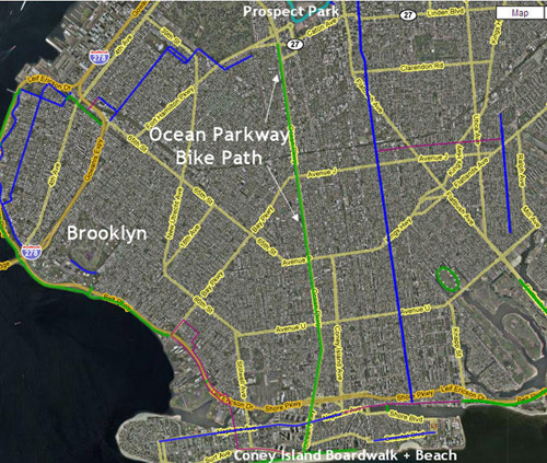
The road begins at Ocean Parkway on the Midwood and Parkville border, runs southwest through Mapleton past Washington Cemetery near the Culver Line stop, crosses into Bensonhurst around 60th Street, and ends at Gravesend Bay past Bath Beach.
| Segment | Neighborhood | Notable landmarks |
|---|---|---|
| Ocean Parkway to Avenue J | Midwood / Parkville border | tree-lined residential blocks |
| Avenue J to McDonald Ave | Mapleton | Washington Cemetery, F station |
| McDonald Ave to 86th St | Bensonhurst | 86th Street commercial strip, D station |
| 86th St to Shore Parkway | Bath Beach / Gravesend | Bensonhurst Park, Caesar’s Bay Shopping Center, Belt Parkway Exit 5 |
These boundaries follow NYC’s Neighborhood Tabulation Area lines, which are drawn for statistical reporting, not street-level precision, so exact cross-streets can vary slightly by source.
Getting to and from Bay Parkway
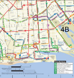
Buses along the corridor are the B1, B6, B82, and B82 Select Bus Service, per the MTA’s station page for the Bay Pkwy stop. All three subway stations also connect to local bus service at their own cross streets.
Where the name comes from
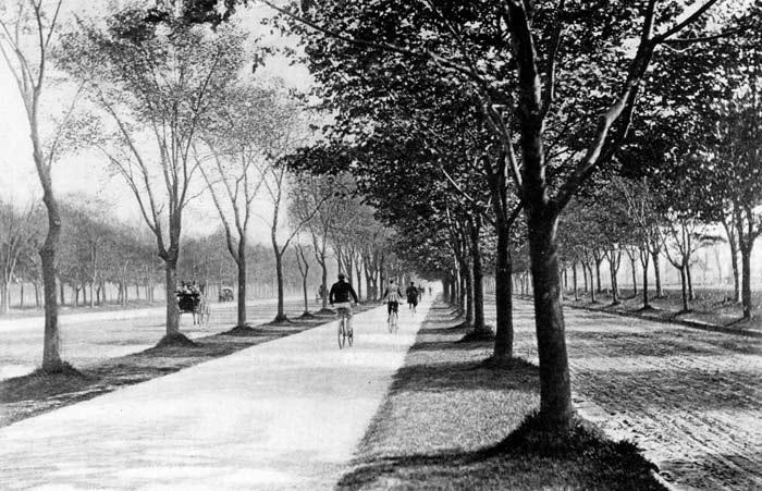
The road was known as 22nd Avenue until Brooklyn Standard Union clippings from 1891 and 1892, unearthed by historian Henry Stewart and reported by Forgotten New York, show it being christened “Bay Parkway” around that time, alongside Bay Ridge Parkway and Fort Hamilton Parkway, in a bid to make the surrounding real estate sound more like a landscaped parkway than a numbered avenue, with no parkland ever actually added.
Why is it called Bay Parkway if it’s not near a park?
Because the “parkway” name was a real-estate move, not a landscaping one: Brooklyn officials renamed several numbered avenues into “parkways” in the 1890s specifically to raise property values.
What’s along Bay Parkway today
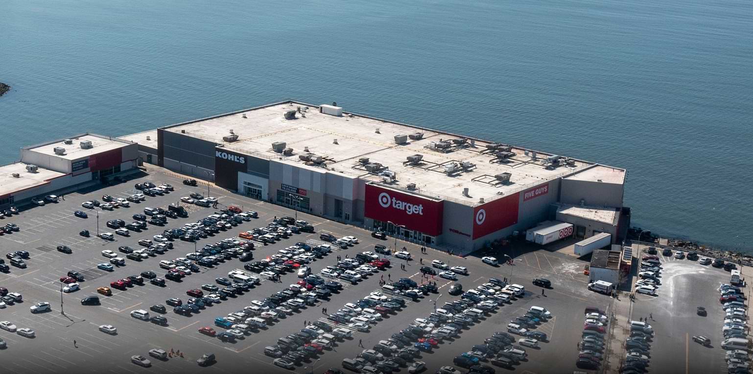
Three different measures point to the same corridor: retail investment, population, and subway use, and they tell somewhat different stories. At the road’s southern end, Caesar’s Bay Shopping Center sits on 14 acres at the corner of Bay Parkway and Shore Parkway. Target opened a 90,000-square-foot, two-story store there in 2020, joining existing anchors Kohl’s and Best Buy. The neighborhood tabulation areas the road crosses hold a combined population well over 200,000: Bensonhurst West at 90,847, Bensonhurst East at 65,502, Bath Beach at 33,020, and Gravesend at 30,587, per NYC’s Department for the Aging demographic report. The F stop at Bay Parkway, meanwhile, has repeatedly ranked among Brooklyn’s five least-used subway stations, a reminder that heavy retail and dense population near a station don’t automatically translate into heavy subway use at that particular stop.
Comments