
Where Broad Channel Is and Why It’s Different
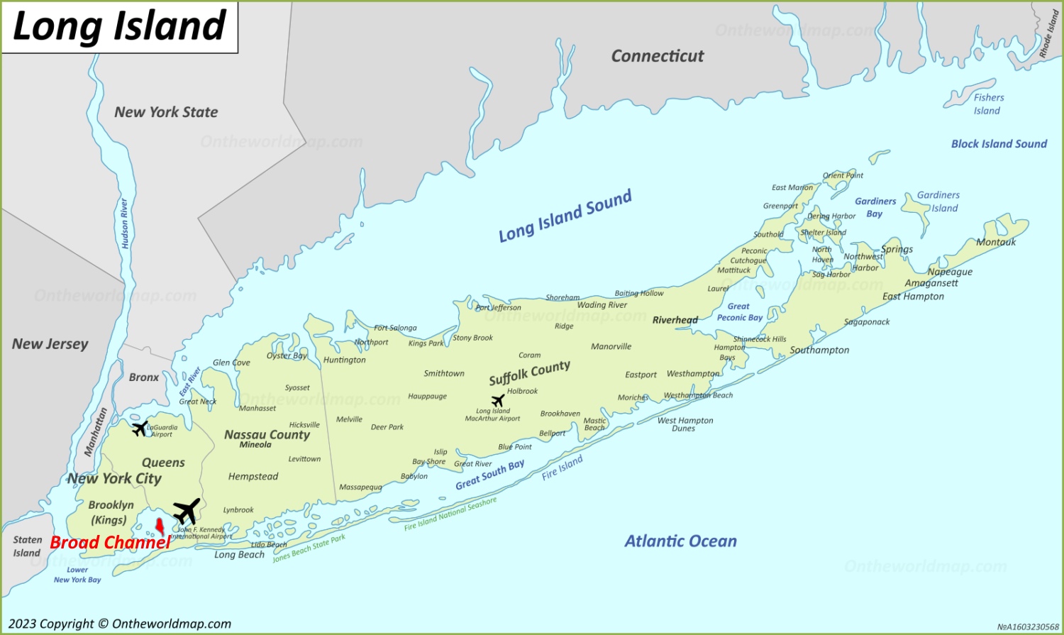
Broad Channel sits on Big Egg Marsh, an island inside Jamaica Bay connected to the rest of Queens only by Cross Bay Boulevard and two bridges. It is the only Jamaica Bay island with year-round residents, and the A/S subway line crosses the marsh on its own trestle to reach it. The community’s roughly 950 houses sit an average of just a few feet above sea level, which shapes almost every decision covered below.
Flooding, Flood Zones, and Insurance: What Buyers Must Know
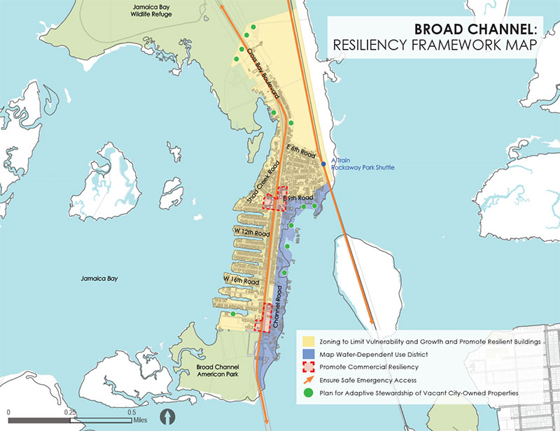
Nearly all of Broad Channel is mapped inside FEMA’s Special Flood Hazard Area, Zone AE, along with the rest of the Rockaway peninsula and Howard Beach. Zone AE carries a documented 1 percent annual chance of flooding, and any home in a high-risk flood zone with a federally backed mortgage is legally required to carry flood insurance.
FEMA Flood Zone vs. NYC Evacuation Zone (They’re Different)
The FEMA flood zone sets insurance requirements and building rules; it does not tell the city who to evacuate, since the City determines which hurricane evacuation zones to evacuate based on an actual storm’s characteristics. Broad Channel was placed in the city’s most flood-prone hurricane evacuation tier, then called Zone A, ahead of Hurricane Sandy, and the city revised its hurricane evacuation zones again in 2021 to reflect improved data. The only reliable way to confirm a specific address’s current evacuation zone is NYC Emergency Management’s Hurricane Evacuation Zone Finder, since it is a separate system from the FEMA flood map.
| Flood factor | What it means | What to check before offering |
|---|---|---|
| FEMA Zone AE (Special Flood Hazard Area) | 1% annual flood chance; triggers mandatory NFIP coverage on federally backed mortgages | Confirm the parcel’s current FIRM zone at the FEMA Flood Map Service Center |
| Base Flood Elevation vs. first-floor height | Sets the premium; a first floor below BFE means a materially higher bill | Request the seller’s Elevation Certificate, or budget $500 to $800 for a new one from FloodHelpNY |
| NYC Hurricane Evacuation Zone (separate system) | Governs mandatory evacuation orders, unrelated to the insurance bill | Look the address up directly in NYCEM’s zone finder before assuming the flood zone answers this too |
A buyer who checks only one of these two systems has checked half the picture.
Do I have to buy flood insurance if I pay cash? Federal law ties the requirement to a federally backed mortgage, so an all-cash purchase in Zone AE isn’t legally mandated to carry it. Going without it in a zone FEMA rates at a 1 percent annual flood chance means self-insuring against a recurring, well-documented risk.
Zoning and What You Can Build or Convert
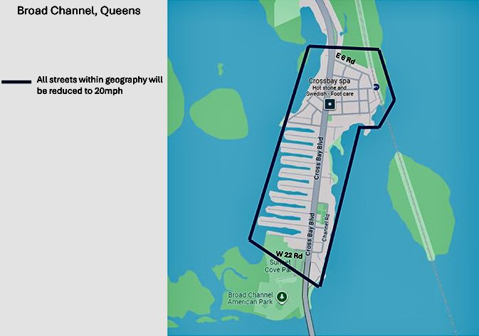
Two zoning designations cover most of the island’s residential and commercial parcels: R3A and C3A.
R3A vs. C3A: What Each Allows
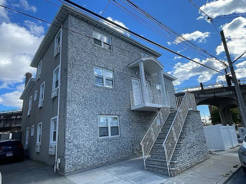
R3A districts, covering most residential blocks, permit modest single- and two-family detached residences on zoning lots as narrow as 25 feet in width, with a base floor area ratio of 0.5. C3A districts, mapped along stretches of Cross Bay Boulevard, permit uses like docking, renting, and servicing fishing and pleasure boats, aquatic sports equipment sales, bicycle shops, and ice cream stores, with residences and community facilities also allowed; the commercial floor area ratio is capped at 0.5, with residential development in C3A governed by R3A regulations. In a mixed building, commercial uses may occupy the ground floor only. A Redfin listing for a two-family property on Cross Bay Boulevard shows an active R3A designation on file with the county assessor, grounding the rule in a real, checkable parcel.
| Zone | Typical use | Key restriction/opportunity |
|---|---|---|
| R3A | Detached 1- and 2-family homes | Max 0.5 FAR (about 0.6 with an attic allowance); no as-of-right multi-family |
| C3A | Marine/waterfront commercial plus residential above | Commercial FAR capped at 0.5, 2 stories or 30 ft max; residential floors follow R3A rules |
| Mixed C3A building | Ground-floor commercial with housing above | Commercial use restricted to the ground floor only |
Can I add a second unit or convert to two-family in Broad Channel? On an R3A lot, yes, as of right, provided the resulting building stays a detached one- or two-family structure within the 0.5 FAR and required side-yard rules. True multi-family apartment construction isn’t permitted in R3A.
The Housing Market: Prices, Volume, and Why the Numbers Disagree
Trailing 12-month data pegs Broad Channel’s median home sale price at $645,000, up 50 percent from the prior year, with homes selling after an average of 101 days on market compared to the national average of 58 days. A separate portal pull for the same ZIP shows a $600,000 median sale price with a 178-day average, and waterfront-specific listings show a $599,000 median listing price.
Why You’ll See Different “Median Price” Numbers
Three things drive the spread. Sample size matters most: this is a small market, and one or two closings, especially a waterfront sale or a teardown, can move a median sharply. Property mix matters too, since single-family, waterfront, and two-family figures get reported separately and don’t average into one number. Least obvious: several widely used “Broad Channel” data feeds pull in listings from outside the island. A Redfin market snapshot attached to a Broad Channel address lists a comparable sale at 319 Beach 47th Street in Far Rockaway, over two miles away and in a different zip code, and Zillow’s “recently sold” count for Broad Channel shows 119 transactions, far more than the island’s roughly 950 total houses would produce even over several years.
| Metric | Recent figure | Source/date | Caveat |
|---|---|---|---|
| Median sale price, trailing 12 months | $645,000, up 50% year over year | Homes.com portal data, early 2026 | Small sample; one high sale can swing this figure |
| Average days on market | 101 days portal-wide; 126 to 178 days on other pulls | Redfin and Homes.com, early-to-mid 2026 | Consistent across sources; reflects genuinely slow turnover across independent portals |
| “Recently sold” count | 119 sales (Zillow); 2,700+ in a related Redfin search | Zillow, Redfin, 2026 | Inflated by sales in Rockaway Park, Arverne, and Far Rockaway sharing nearby zip codes |
Why did I see three different “median price” numbers for Broad Channel? Ask whoever quotes you a figure how many actual closed sales sit behind it and whether they’re limited to Broad Channel addresses. Several public feeds include sales from neighborhoods that merely share a nearby zip code, so the headline number alone doesn’t tell you the sample it’s built on.
Renting in Broad Channel
No reliable, Broad-Channel-specific rental benchmark could be confirmed for this guide. Searches for rental listings under the Broad Channel neighborhood name return results in Arverne and Far Rockaway, several miles away, rather than units actually on the island. For an investor weighing a buy-to-rent strategy, that absence is itself the finding. Standard rent-comp tools don’t have enough genuine Broad Channel inventory to produce a trustworthy number. Any rent projection here should be built from a handful of directly comparable, verified local leases instead.
Schools

Broad Channel’s zoned public school is P.S./M.S. 47, the Chris Galas School, serving 3-K through eighth grade. High school placement in New York City runs through a separate, citywide application process rather than neighborhood zoning, so a Broad Channel address doesn’t determine which high school a student attends.
The school itself is a useful data point on how seriously the city now treats flood risk here. The Department of Education’s School Construction Authority completed a $49.9 million, four-story replacement building for P.S. 47, opening for the 2023 school year with 260 seats, full air conditioning, and solar panels. Broad Channel Civic Association President Dan Mundy Jr. described the site as above the floodplain, and the prior building had been running at 140 percent of capacity before Hurricane Sandy damaged it. The new building officially opened its doors on September 13, 2023, after 18 months of construction.
| School | Level | Zoned or citywide | Notes |
|---|---|---|---|
| P.S./M.S. 47 Chris Galas School | 3-K to grade 8 | Zoned (attendance-zone school) | Rebuilt 2022 to 2023, $49.9 million, 260 seats |
| NYC public high schools | Grades 9 to 12 | Citywide, application-based | Not determined by Broad Channel zoning |
Getting Around and the Single-Road Risk
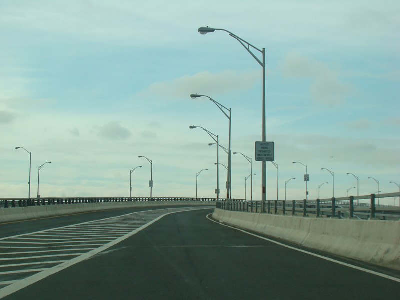
Cross Bay Boulevard and its two bridges form the only road connection between Broad Channel and the rest of Queens, and the A/S subway line crosses the marsh on its own elevated trestle to reach the Broad Channel station, a routing unmatched anywhere else in the subway system. That single approach is a commuting quirk on an ordinary day and an evacuation bottleneck on a bad one: the hurricane evacuation zone system exists specifically because storm surge can isolate exactly this kind of access point, independent of whatever a given parcel’s FEMA flood zone says about it.
Daily Life: Shopping, Dining, and Errands
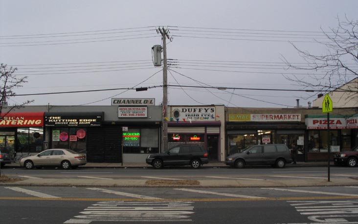
Commercial activity on the island is limited, with a short strip near 9th Road carrying the basics, while most residents drive to Howard Beach for anything more. For a year-round buyer, that is a genuine lifestyle constraint worth weighing against the appeal of quiet, low-density streets.
Is there a full grocery store in Broad Channel? No. The commercial strip near 9th Road covers items like a pizza place and convenience basics; a full supermarket run means driving off the island, typically to Howard Beach.
A Brief Note on Land History (1982 and Before)
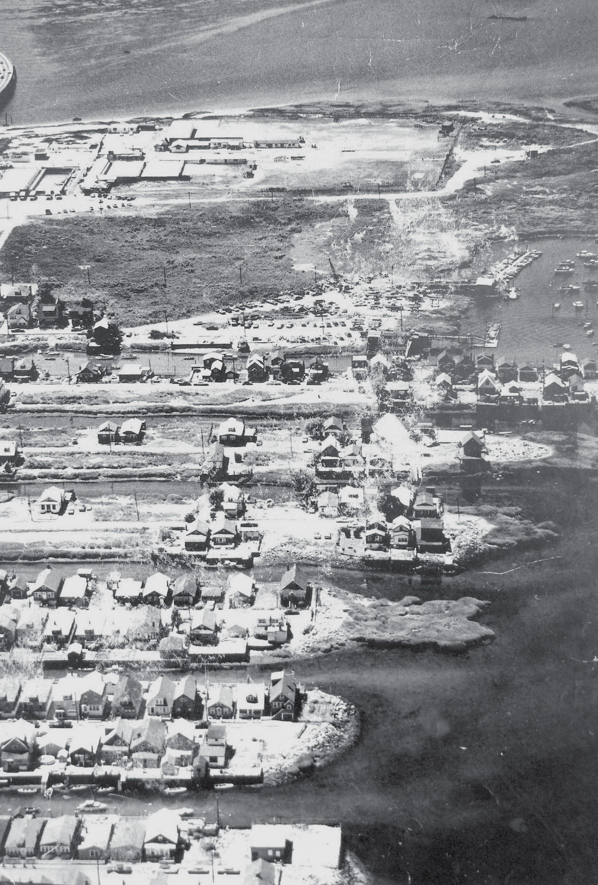
For most of the 20th century, Broad Channel’s residents did not own the land under their houses, fighting repeated eviction and lease-renewal threats from the city over four decades. That standoff ended in 1982, when the Koch administration concluded successful negotiations with the community, bringing a sewer system, a library, and a new P.S. 47 along with the right to purchase the land outright. Mayor Koch arrived by helicopter on September 14 of that year to present the first deed in person, after homeowners won the right to purchase through state legislation.
Do I own my land outright, or is there anything unusual about title here? Current owners hold standard fee title. What’s unusual is the history behind it: the city itself owned the land under every house until 1982. A title search on an older property here is worth the standard diligence, and a real estate attorney is the right party to confirm current status on a specific parcel.
Is Broad Channel Right for You?

Owner-Occupant, Year-Round Family
The single-road commute, the missing full grocery store, and the flood-insurance line item weigh most heavily on someone living here full time. Confirm the elementary/middle school zoning fits your child’s grade, budget insurance at Zone AE rates instead of a citywide average, and visit during both a calm week and, if possible, a heavy-rain forecast.
Investor / Buy-to-Rent
The rental market here is too thin to trust a portal-generated rent estimate. Build a comparable-rent analysis from verified local leases, and factor the R3A ceiling on multi-family conversion into any plan to add rental units.
Waterfront / Second-Home Buyer
Waterfront listings carry the highest flood-insurance exposure and the widest price variance in the data above. Get an Elevation Certificate before making an offer, since it affects both financing and ongoing carrying cost.
Comments